Tropical depression forms in East Sea

VOV.VN - A tropical depression formed over the northern East Sea at noon on June 24, bringing winds of up to 49 km/h, and is unlikely to intensify into a storm within the next two days.

According to the National Centre for Hydro-Meteorological Forecasting, due to the influence of the tropical depression, the northern East Sea, including the Hoang Sa archipelago, will experience thunderstorms and strong winds at level 6–7, gusting to level 9, with sea waves reaching 2–4 meters. Vessels operating in these hazardous areas may be affected by lightning, squalls, strong winds, and rough seas.
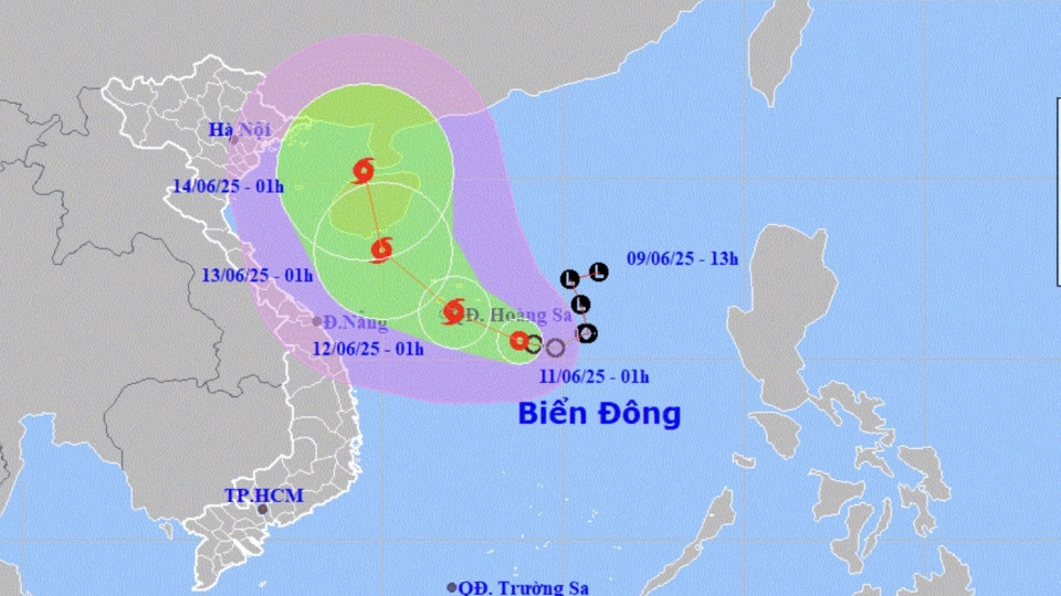
Ten days ago, tropical storm Wutip, the first storm of 2025 in the East Sea, did not make landfall in Vietnam, but its western circulation caused prolonged heavy rainfall across central provinces from June 11 to 13. Rainfall from central Quang Tri province to Da Nang province ranged from 300 to 650 mm, with Nam Dong in northern Hue province recording 768 mm.
The downpours caused rivers such as the Thach Han in Quang Tri and Bo in Hue to rise above level 3, the highest warning level. The Huong and Vu Gia rivers reached level 2, while the Kien Giang River in central Quang Binh province exceeded level 3 and receded slowly.
Flooding left 11 people dead in Hue City, Quang Tri, and Quang Binh; over 3,500 houses submerged; and around 88,000 hectares of crops inundated. Dozens of sites along national and provincial highways suffered landslides and flooding. Transport and aviation services were disrupted, with more than 20 flights at Da Nang cancelled or delayed. The Miss Vietnam pageant final scheduled for June 14 on the Huong River had to be postponed.
The National Centre for Hydro-Meteorological Forecasting described Wutip as a particularly unusual and extreme storm, rarely seen in the history of central Vietnam’s meteorological records. It was the first storm to appear in the East Sea during June in over 40 years, and the first to trigger such extreme rainfall in the central region during this month since 1952. The storm’s circulation caused an unusually early and severe flood, with water levels in many areas reaching the highest point in June over the past 30 years.
This year, 11 to 13 storms and tropical depressions are expected to form in the East Sea, of which five to six may directly impact mainland Vietnam. The northern region faces high risk from July to September, while the central and southern regions are most vulnerable from September to November.
Tropical depression changes course, likely to strengthen into storm today
VOV.VN - A tropical depression that formed in the East Sea on June 10 has changed its direction and is likely to gain its strength into a tropical storm on June 11, according to the National Centre for Hydro-Meteorological Forecasting.

